
Project on Ecosystem Survey and Design for the Restoration of
the Phra Chedi Klang Nam Mangrove Forest (100 Rai)
The Phra Chedi Klang Nam mangrove area in Rayong Province is a vital natural resource with rich biodiversity and plays a critical role in carbon sequestration, contributing to ecological balance. However, this area has faced degradation due to land-use changes. In response, the Ecosystem Survey and Design Project was launched to rehabilitate 100 rai of this mangrove forest, serving as a model for Nature-Based Solutions (NbS). The project is being implemented over a three-year period (2023–2025) through a participatory process involving local communities, academic institutions, and strategic partners. Its goal is to create a focused, systematic, and sustainable approach to mangrove restoration.
Project Objectives:
- To survey and redesign the water flow system and address water pollution problems in the 100-rai Phra Chedi Klang Nam mangrove area through collaboration with surrounding communities.
- To prepare for the establishment of a collaborative mangrove seedling propagation center.
- To develop a site-specific ecosystem model for the restoration of the 100-rai mangrove area.
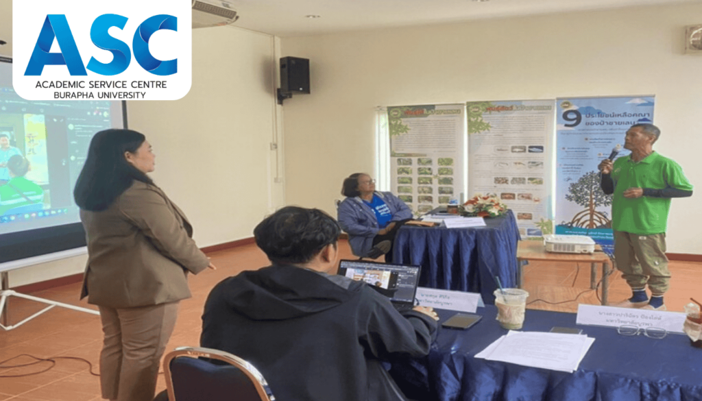
The project officially commenced its ecosystem survey and design phase on October 8, 2024, and will continue until January 8, 2025, in Mueang District, Rayong. Initial efforts included organizing meetings with local communities and relevant stakeholders to define project goals, survey methods, and identify community needs. Fieldwork involved the collection of topographical and boundary data using GCP and RTK GPS technologies. Surveys focused on identifying water pollution issues and water catchment areas. The data gathered was analyzed to support the development of a wastewater management plan and a geographic model of the restoration site.
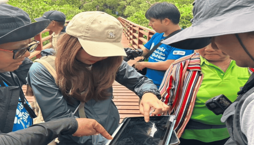
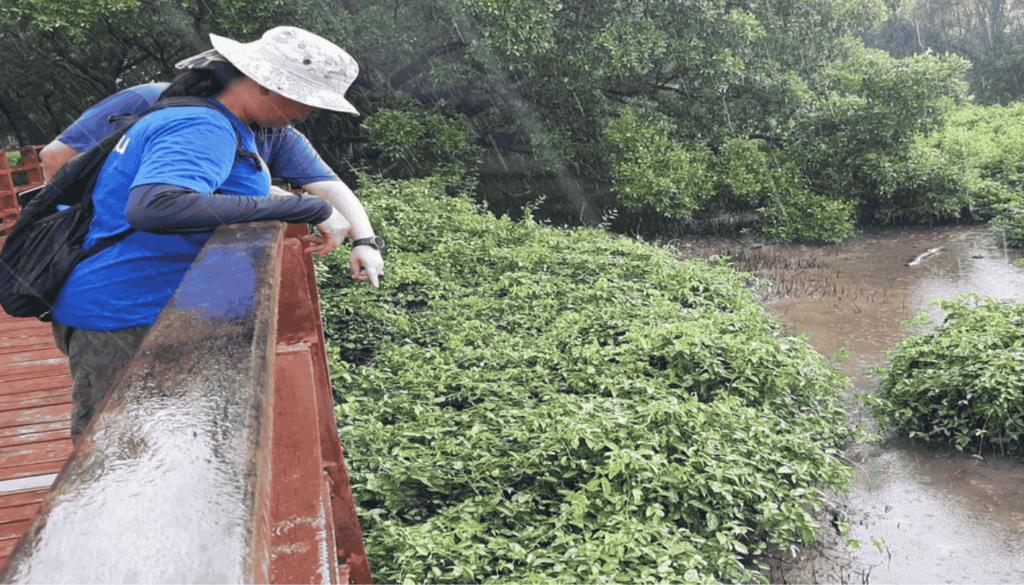
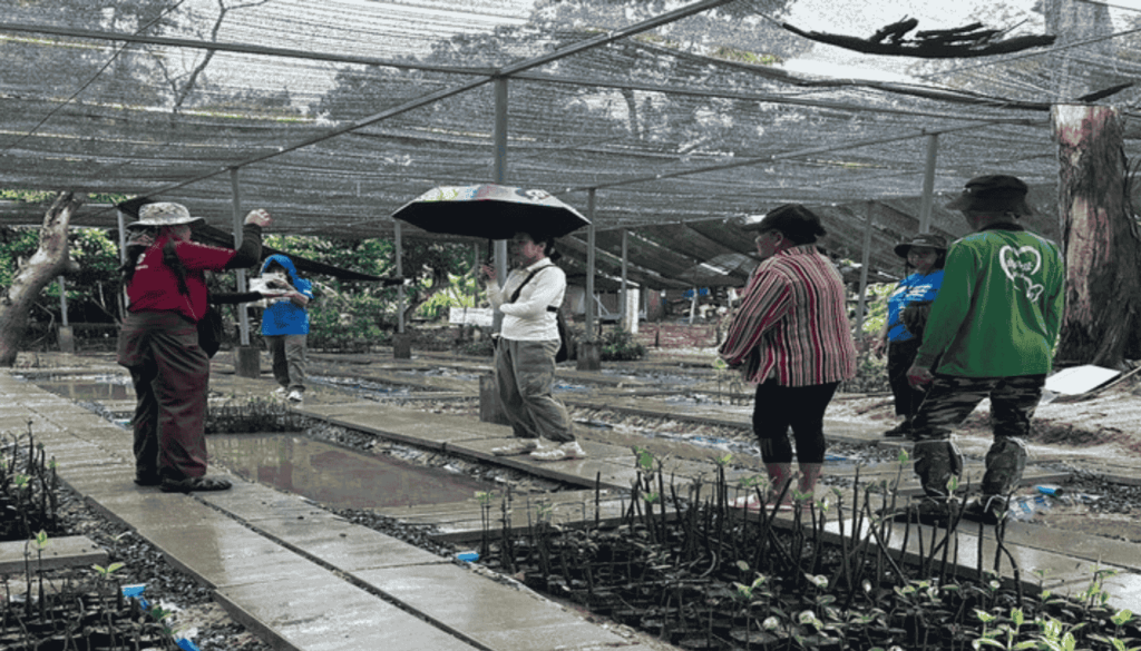
The project officially commenced its ecosystem survey and design phase on October 8, 2024, and will continue until January 8, 2025, in Mueang District, Rayong. Initial efforts included organizing meetings with local communities and relevant stakeholders to define project goals, survey methods, and identify community needs. Fieldwork involved the collection of topographical and boundary data using GCP and RTK GPS technologies. Surveys focused on identifying water pollution issues and water catchment areas. The data gathered was analyzed to support the development of a wastewater management plan and a geographic model of the restoration site. In parallel, the project has begun planning the adjustment of water flow directions and preparing for the establishment of a mangrove seedling propagation center to support long-term ecological rehabilitation.
Project Impacts:
- The project resulted in clearly defined restoration zones, with precise geographic boundaries and reliable geospatial data for future reference.
- Detailed elevation data of the mangrove area was obtained and compared with sea level data, providing critical insight into suitable plant species for the area.
- A concrete wastewater management plan was developed for the Phra Chedi Klang Nam mangrove forest.
- A participatory process was established, empowering the local community to take an active role in steering the restoration and ensuring long-term sustainability.
- Natural resources and ecosystems in the surrounding area have begun to recover under community-based stewardship, fostering a sense of care and responsibility for environmental conservation.
- Certain conserved and reintroduced plant species have enhanced the area’s ecological function by providing food and habitat for local wildlife.
- The project has promoted sustainable resource use for local communities, both in terms of eco-tourism potential and long-term environmental benefits.
Project Leader: Mr. Sakul Sirikit, Academic Service Centre, BUU